So far, so good. The concept of "square" is not really that difficult - you would think. Four right triangles equal distance apart - right? But, to me it never seems that easy in practice. Fortunately, Matt's garage is based on a perfect square square with walls 30 feet apart. Not that hard, you would think.
Well, to be honest, it always seems difficult for me. But, that's why building is a challenge and fun to do - or at least it's fun most of the time. BUT, we got the plywood on the first floor and we squared it up within an eighth of an inch on the diagonal measurement. Voila! Easy!
So away we went building the gable walls.
Here's Matt nailing the northwest wall that looks out over Sitka with a view of Mt. Edgecumbe. Note the big windows!
These walls are about 14 feet high at the highest point.
See how easy it is to lift the wall up? Four guys with one finger!
See Matt with his Search and Rescue helmet on to protect that huge brain.
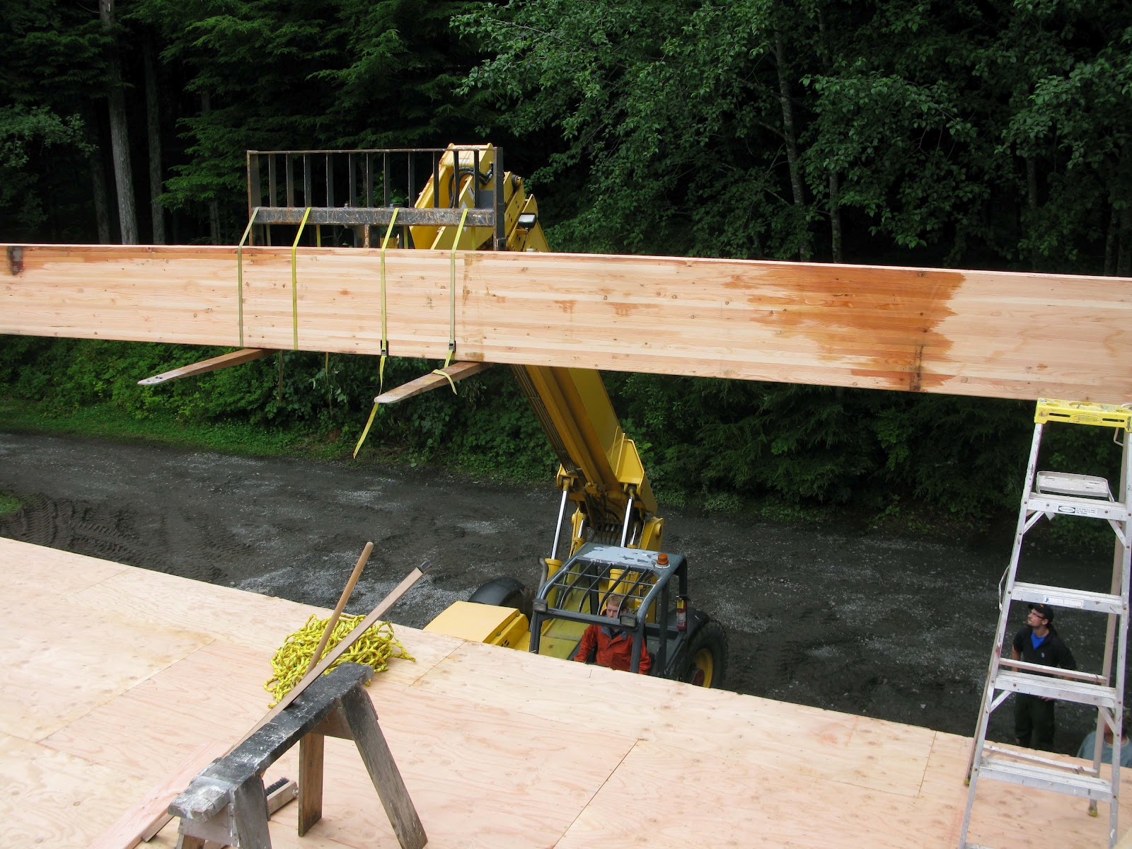
I mentioned earlier that they let people that don't know anything rent dangerous equipment. We drew straws to see who got the nod and Sam won.
Just a little tip for your next construction project, don't fix the beam to the forklift - get a strap and let it hang. With the system you see in the picture to the left, there's no flexibility to be able to move the beam. Live and learn.
This beam is big: 24 inches high, 6 3/4 inches wide, and 29 feet, 11 inches long.
It's there, but not quite right. But it's late on a Friday night and time to go home.
This is the streetside view.
It would have been nice to have some side walls for strength, but the design is based on 4 feet of steep pitched roof with a 22 foot dormer roof. Matt decided to take out the 4 feet of roof on the back right side - which is why you see two different roof angles in the picture. Maybe we should have at least built that wall first, but we wanted to see what the gable windows would look like.
This is the "back" of the building.
Whew, a major step forward - roof beam up, Matt had no need for his helmet, and the forklift was ready for returning with no problems.