Saturday, June 30, 2012

Definition of "Remote"


Maybe I'm using a poor analogy, but like Bob Marshall, I've always been interested in places away from people - as he describes, "blank spaces on the map."  At the same time, I'm no adventurer in any category like Bob Marshall or the many adventurers that run rivers that haven't been run before or walk places that haven't been walked before . . . and many other examples.  But I do love the natural world and being away from other people. But what is "remote' in our day and age? 
Yes, I've decided it is how many jet trails you see.   A couple of years ago, we rafted the Tatshenshini-Alsek Rivers.    What a great trip.  We saw maybe 30 people in 10 days.  But we saw regular jet trails as travelers flew over us from Juneau to Yakutat or Anchorage eating their free soy mix and quaffing one plastic glass of soda/pop.

In the Brooks Range?  After our drop off at Circle Lake, we saw no other people for 7 days.  It was 3 days before we saw a jet trail.  And we did see one a couple of days later.  Disappointingly, the fourth day of our trip we encountered 2 sightseeing single engine planes way up a canyon in the Arrigetch Mountains.   And, finally, we heard another couple of small planes during the week, but never saw them.

And, in full disclosure, we arrived back in our Arrigetch Base Camp after a glorious day hike, greeted by a poorly written note noting that I (yes, it was me!) did not put my emergency Mountain House Rice and Chicken away in the bear proof can.  I felt fortunate that someone in the National Park Service flew into the area at great expense in order to guard my safety.

Next time you go out remote, look for jet trails.  The fewer that you see, the farther out you'll be.  I know that I'll never see as few in one week as our Brooks Range trip.

Thursday, June 28, 2012

Wrap up . . .

After 4 days and about 900 miles of driving (roughly 450 miles each way although the official mileage to Deadhorse is 414), we arrived back in Fairbanks for the long trek home through security lines and sardine packed airplanes.  

Alaska is so huge and diverse.  There's still years of discovery, but we certainly saw much more than I had before I started.  I would not have traded the experience for anything and I feel like I have a much better understanding of our own State.  It was a great way to go: backpacking, river rafting, and driving.

Crack open an Alaskan IPA, and toast to the great State of Alaska.  But don't forget to lift the mosquito net first.


Wednesday, June 27, 2012

Dalton Highway, Day 4

Yesterday, we drove back to Coldfoot for gas and the dinner buffet.  We stayed at Marion River Campground again, and visited the Visitor's Center for a real bathroom and an evening information session.

It was time to get back to civilization and escape the mosquitoes.  We took off from Coldfoot headed for Fairbanks.  Here are some general road photos just to show what it looked like.


But first, a musk ox picture from yesterday.  He or she was just hanging out not far from the road.


There are trucks, but I thought they were a bit overrated.  We didn't have any problems sharing the road, although I'm sure there are lots of broken or pockmarked windshields.    It was clear that much of the freight to Deadhorse was moved by truck, however!


Just a picture of the road.


Looking south down Atigun Pass (highest point on the road).


We're back to seeing trees.


You can only find cell phone coverage in Deadhorse and a little outside Fairbanks.  Remember those things that are connected to the wall?  Here's the Coldfoot "phoneroom."


There were HUGE expanses of past forest fires, more than the eye could see - and there wasn't much obstructing the view.


If you see the road, usually you'll see the pipeline.  Eighty percent of it is above ground.  The only time it is below ground is areas where there is no permafrost. 

The shape of the pipeline here is due to possible earthquake tremors or other movements of the pipe - the angles can absorb the potential push and shove.


The car got a bit dirty with a little rain.  Close the door fast so the mosquitoes don't get in!


We must be back close to Fairbanks!  The phone is out! 

Tuesday, June 26, 2012

Dalton Highway, Day 3

Another quick "pack up the gear, throw it in the car, and go" morning, but we had to get there for the tour.  We did, for a total of 430 miles.

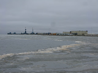
The tour was great - we learned many things that we would not have - plus, we got to see the Arctic Ocean.  No one actually lives in Deadhorse or any of the three main camps in Prudhoe Bay - everyone, of which there were roughly 8000 people working in the three camps - works two weeks on and two weeks off or three on, three off.  The least paid employee makes no less than $65,000 a year.  There are absolutely no drugs, alcohol, or firearms permitted.  If you partake, you are escorted to the airport and are extradited immediately.  If you miss your flight to work, you are fired immediately.  People work on the north slope from all over the U.S. and some international.  One person we were told about commuted from England.


Two active drilling rigs.


We made it halfway.


Tourpeople dipping in the Arctic Ocean.


The caribou don't seem to worried about the oil business going on in the background.


Most of the drilling and exploratory work goes on during the fall, winter, and early spring.  Here are a few of the vehicles used in the winter.


Almost July and there is still ice in the water.


OK, we've seen what we can.  It's time to turn around and go back the way we came - the only way!


Lastly, the video below shows a 360 degree view of Deadhorse surrounding the lake.

Monday, June 25, 2012

Dalton Highway, Day 2

The town of Wiseman is not far from Coldfoot.  Unlike many of the old mining towns, Wiseman still survives with people in it - although not many.  After a fast break-down of camp and throwing gear in the car due to mosquitoes, we drove the 5 miles to Coldfoot for the breakfast buffet and then u-turned for a short 15 miles the other way to Wiseman.


Wiseman is an old mining town.  Bob Marshall's book "Arctic Village" is about his year staying in Wiseman in the 1930's.

Glenda had heard that a guy by the name of Jack Reakoff gave tours.  We just happened to run into one of the tours and asked if we could tag along.  Fascinating.  Jack (and his sisters) grew up in Wiseman, and still live there.  He lives off the land in one fashion or another: hunter, trapper, pilot, gardener, fisher, and tour guide.


Here is Jack's moose horn sculpture in the picture on the right.  After the tour, he invited us to his home and we sat around an listened to him talk.  I thought the most interesting was the impact of the Haul Road on the area - mostly in the fact that big moneyed hunters were able to access hunting grounds - and did - with a negative impact on the animal populations.

Jack had amazing gardens!

All in all, Wiseman was a very interesting place to stop.


Off we went to make some miles.  Our plan was to stay in the last campsite before Deadhorse.  You can't drive to the Arctic Ocean so Glenda had called to put us on the tour that gets you through the "secure" areas to the ocean.  The tour started at 9 a.m. the next day so we had to be within reasonable driving distance.

We ascended the Atigun Pass and dropped onto the arctic plain - next stop, Last Chance campground.  

Last Chance campground's only facility was a pit toilet.  As you can see, there isn't many trees to pitch your tent under - although there was lots of muskox poop.


Furthermore, there were mosquitoes galore.  We managed to get through dinner, but dove for the car for after dinner gin rummy.  Open the door quick, shut it, and kill the mosquitoes that got in.  At least it wasn't too hot.


Sunday, June 24, 2012

Dalton Highway, Day 1

After the previous day of Bettles to Fairbanks, and then renting a car, getting food for the trip, seeing Ashley and Joey off, and of course packing and repacking gear, we were off for the Dalton Highway in our fancy SUV.  But, I must admit, that it was a nice night with a real bed, another shower, and a good meal and beer at the Silver Gulch Brewery.

Bob got us going on the Dalton Highway, otherwise known as the "Haul Road" or the "Ice Road."  It's called the Haul Road because much of the material and supplies for the original oil pipeline and for Prudhoe Bay are hauled on the road - in fact, the road was built for that purpose.  The Ice Road was made "famous" from the TV show "Ice Road Truckers."  Anyway, Bob had always wanted to go and asked if we wanted to go along.  It had been on the back burner for years for me too, but I figured I'd never get the chance.  But here it was.


But first, a stop at the Trans-Alaska Pipeline Visitor Center, which is interesting and you can get right up to the pipeline.  No matter what you think about the pipeline, I think it's an engineering marvel.  After 34 years or so, it has stood the test of time.  Mary Louise at 5 foot 2 inches or so gives you some perspective.


There's no building here, but information and a few displays like the one on the left.  You can see the "cleaning pig" that is sent through the pipe to clean the inside.  What will they think of next?  There are lots of engineering aspects of the line that are very interesting, but I won't bore you now.


It rained off and on during the day - not much but enough to discourage pictures.  You can see some blue sky above the Yukon River, though.  Again, I won't wax boringly about the length and volume of the Yukon River and the extraordinary life of the salmon that go all the way up it to tributaries hundreds of miles from salt water and the Alaska Natives that rely on the salmon.  But it's amazing.


We drove for about 250 miles from Fairbanks to Coldfoot.  The country is so vast.  Much of it is rolling or fairly flat with small spruce, alder, and willow trees and bushes.  There's lots of water evident: streams, ponds, lakes.


We drove 263 miles to Coldfoot (actually we stayed in Marion Creek Campground.  As you can see in the picture on the right, the bugs were bad and the beer was good.  Plus, we're having a beer with a pile of moose poop in front of us.   The campsite was buggy at best.  We celebrated out anniversary!


Coldfoot is the only "civilization" to buy gas in the 500 or so miles between Fairbanks and Deadhorse (Prudhoe Bay).  Luckily it also has a good buffet meals for the scientists and truckers and tourists that frequent the area.  We had a great roast beef dinner and there were no mosquitoes on the porch, a special relief.

I observed an interesting thing while sitting back by Bob and Mary Louise.  A woman, marked by REI and LL Bean type clothing, came out of the restaurant door and very carefully placed some type of bug or insect outside on the railing.  There were two construction guys sitting quite close nearby.  She turns around and goes back inside.  One construction guy looks at the other with a big question on his face with a "are you kidding me look."  He takes off his hat and smashes the bug.

If you go, visit the visitor's center in Coldfoot.  It's worth a visit, for sure.  Plus, they have real bathrooms.


Saturday, June 23, 2012

Ruminations on the Brooks Range - Robert Marshall


This was our day to pack and repack gear, return the bear barrels, buy a Brooks Range Aviation hat, and generally scurry around.  When we got on the plane to leave Bettles on the way to Fairbanks, I asked the pilot when drinks would be served.  He said, "No drinks served. Do as I do and have a couple before the flight."

It's always fun to discover interesting people, whether past or present.  Although I had heard about Robert Marshall related to conservation and nature, I hadn't read any of his work.  When I got home, I read "Alaska Wilderness, Exploring the Central Brooks Range." 

It was a fascinating description of the area that we had just experienced ourselves.  But much of the reason that we were able to enjoy it was due to Bob Marshall recognizing how unique the Brooks Range is and that it should be preserved for all generations.  

I'm getting ahead of myself.  Mr. Marshall was fascinated with blank areas of maps in the United States.  His training was in forestry.  He did much of his Alaskan exploration in the 1930's.  And he did it without goretex or capilene.  

He's not a great writer, but he's real.  He writes about mosquitoes:

"I also made the acquaintance  of arctic mosquitoes while boring spruce trees.  These insects were terribly thick; at one time I counted forty three between my waist and neck including my arms.  With hat and mosquito net rendering my head, face, and neck inaccessible to them, and gloves and gauntlets protecting my hands and wrists, and all the rest of me covered with normal clothing, I really was not bothered except when I occasionally had to remove my gloves; but I could see that anyone caught in this country for several days at the height of the mosquito season without special protection would surely be killed." (p. 7)

On the next page, he writes about tussocks:  "There we had our first taste of arctic sedge tussocks.  These curses are tufts mostly of cottongrass which gradually build up out of the swamp, the younger plants growing out of the dead remains of the earlier ones.  As they grow larger, they also grow wider so that they are much bigger on top than below, becoming more or less mushroom shape.  They get to be eighteen inches high, some even higher.  They are very topheavy, and when you step on them they are almost certain to bend over and pitch you off into the swamp.  When you try to walk in the  swamp, you have to step over these high humps, and sometimes they grow so close together your foot catches in between.  Three quarters of a mile of this seemed like five, and at one place we were afraid we could not get the horses through.  We were to find out later that this was easy compared with some places on the North Fork."

Bob Marshall mapped most of the Central Brooks Range in various trips, which filled in the blank spaces on the map.  Among many other credits, he was a founding member of the Conservation Society.  Unfortunately, he died of a heart attack at the age of 38.  I can't wait to read Arctic Village and some of his other works.

Friday, June 22, 2012

BIG DAY: Return to Civilization, Part II

We arrive in Bettles about 5:30 p.m. - a good 4 hours after the others.  Glenda tells us how the plane was loaded with lumber and building materials for a remote lodge - where the plane went before it picked us up.

Glenda greeted us and escorted us to the "Bunkhouse" and associated real bathrooms and showers!  A shower feels good after 11 days without one.  Then we joined the rest of the group on the porch of the classic Bettles Lodge.

The sun shone on us, most of the mosquitoes were behind a screen, and we had beer and real food served to us on a plate!  Luxury!  The cards are out and we're all holding our ears from the noise.  The refueling station is where you see the red and white crosshatch.


Not only that, we had entertainment.  There was a forest fire (started from the town dump, a typical problem in Alaska) in Allakaket.  The planes in the picture on the left are fire fighting planes new to Alaska, Fire Boss AT802.  The plane can and scoop up 800 gallons of water in a minutes and then dump it on the fire.  The three planes flew in so the pilots could have dinner.


Unfortunately, I don't have a picture, but various helicopters landed to refuel.  Helicopters were delivering scientific parties to study road conditions between Bettles the Dalton Highway, through Bettles, and all the way to Ambler for Governor Parnell's "mining road."  (The short article here will fill you in if you're interested.  More on this later when I tell you about the Dalton Highway in later posts.)

By this time, Bettles was running out of aviation fuel.  Time to get some more!  Just fly it in!

It was 8 p.m. before the fuel plane showed up - flown in from Fairbanks by the Everts Air Fuel company.  But you have to remember it is the second longest day of the year - not only that, but above the Arctic Circle the sun never sets anyway.

I thought this was a DC-3, but it's a C46 as identified by a classmate of Mary Louise.  


Mary Louise took a picture of the logo on the side of the plane which we all appreciated.  After that, ML wandered around the planes and helicopters talking to all the pilots and fuelpeople. Luckily she didn't get run over.


By this time it was getting late and it had been a long day.  Ashley was the first to peel off to bed, followed by Bob and Glenda.  Mary Louise had Joey on the ropes in an exciting game of gin rummy, but he escaped with a win.  I was a woeful last.

The mosquito ridden "bunkhouse" without opening windows was a bust.  Half of us pitched a tent in the yard sometime well after midnight to get some sleep.  At least you don't have to have a headlamp to set it up.  So much for civilization.

What a great day.  I'll leave you with another great airplane, the DeHavilland Beaver.  Production of this plane ended in 1967 - and there are still lots of them flying.  Alaska wouldn't be the same without the Beaver workhorse.  Here it takes off from Malemute Fork with 2 rafts, 4 adults, and lots of gear.   Get out your earplugs.  See you later!


BIG DAY - WE RETURN TO CIVILIZATION Part I!!!

 This was a big day.  In fact, there have been a few days in my life that make a deep impression on my psyche as "classically Alaskan" - events or time reflect characteristics of the unique State that we live in and will stay with me for a long time.  This is one of those days.   

If you're an experienced adventurer, you're wondering whether we were really getting anywhere on the river and how we're going to get out of there and return to civilization.  Actually, we were wondering the same thing!  We were supposed to get picked up by Brooks Range Aviation (yep, go with them - they were really nice to us) at Malemute Fork at 10 a.m. in the morning.  But . . . we weren't going to make it despite our best efforts.


Up at 6 a.m. and a record time getting ready - probably because of the prevalence of mosquitoes.

It's routine.  Lather suncreen before the 99% deet bug spray with a final spriz from the pressurized "BUG DEFOGGING" spray can.  I'm starting to like it!

Another beautiful day!  The Alatna river is widening and the terrain is flattening out even more.  We can still see mountains in the background.

MODERN TECHNOLOGY can be a relief in more ways than one.  I'll choose this one today: Satphones.
Ashley is doing all the work calling Brooks Range Aviation while the rest of us are standing around "with our teeth in our mouth" (as our father used to say).


One of the best parts was that we were tagging along on Joey and Ashley's trip!! They had to do the organizing work!! And they did it well.

Thanks, Ashley and Joey.


WE DID IT - fighting through gale winds, hot sun, and mosquitoes.  We arrive at Malemute Fork where the a tributary of the Alatna River joins the Alatna.  But, exactly where do the planes pick us up?  That is the million dollar question.  We check the pick up description that Ashley very carefully wrote down 10 days ago.  Then MODERN TECHNOLOGY shows up again and Joey relents and checks his handheld GPS for the longitude and latitude that Ashley also carefully recorded 10 days ago.  The directions don't coincide with the GPS.  Time to use the Satphone.  We're there!  Right where we should be!   (As an aside, the 6 of us experienced a previous trip where it wasn't quite so easy, but that's a whole different story.)


We had time to take a picture.  Everyone always makes fun of me for my "camera teetering on some log time delay pictures," but this one turned out pretty nice.  Mary Louise is ready for the mosquitoes.

  Rafts deflated and rolled up, gear packed for the plane, lunch eaten, and we were ready.  Most of us are now quite excited about taking a shower.   It wasn't too long before the red and white showed up.    Chuck the gear in the plane and away they went.
Mary Louise and I volunteered for the second flight.    Mary Louise and I were careful to keep bear spray, bug spray, a stove to heat water, and some Starbucks packets.  Fortunately, the peach schnapps was all gone. 

A couple of hours later, the DeHavilland beaver showed up for us.  We didn't even need the bear spray.   If you haven't flown in a beaver, you're missing something.  Make sure you have your ear plugs when you do.

Stay tuned for Part II coming up!

Thursday, June 21, 2012

Day 3 on the Alatna: SOLSTICE!!!

Ashley and Joey had been planning on a fine solstice celebration since we started.  In fact, we had been sipping on the peach schnaps, courtesy of Ashley and Joey, in anticipation of June 21 since the beginning of our trip.  Yes, peach schnaps - but better yet, it was contained in some kind of peach water bottle or something - peach on peach.  I wouldn't touch it at home, but is tasted surprisingly good on the hike!

We decided since the solstice was a special day that we'd get up at 5:30 a.m. and see some animals.  We'd certainly seen the tracks, but we were short on real sightings.  Yep, saw one duck and called it good.

Beautiful day, not a cloud in the sky - but the wind started right away.  Although people tend to exaggerate wind speed, it had to have been between 15 and up to 30 miles per hour in the gusts.  We paddled hard for 2 hours, lay on a sand bar for half an hour, and paddled for 2 hours again - and again - and again.  At our ages, I thought we were quite studly.  We still needed a rest.  Whew!  I thought this was going to be a float, not a paddle.


Look at that sky.

 At least when the wind blew, the mosquitoes were fewer.


The river started to change character as we left the mountains.  We saw many more birch trees, rocky shores, and the river banks were higher.

After a long day of paddling, we had a solstice feast of couscous, chicken, decaf coffee with Baileys, and Joey and Ashley's river cooled cheesecake. 

Then it was time to wipe the sand off the feet and go to bed!  After all, there's not much difference in solstice light when it's light 24 hours a day anyway!!!

HAPPY SOLSTICE!!!   May your feet be washed and clean!


Wednesday, June 20, 2012

Day 2 on the Alatna, Grit on the Face

Mary Louise got the sunny side of the tent.  It was so hot, she got up and waded around the glacial river to cool off.  Then, back in the tent, she just fell asleep when the wind blew a raging barrage of grit and sand into her face.  Nice wake up - everything in the tent and on our bodies was covered with silt.


This picture shows a sand/grit storm earlier in the day.  The wind was howling!   Try to paddle against that stuff!


In fact, we were exhausted from paddling.  We paddled hard for an hour or more, and then landed on a sandbar and did what you see here on the left.


Whew!

The river curled from one side of the valley to the other and seemed to go nowhere.  Or at least we didn't seem to be going anywhere, but I guess the river did. 

We found a nice place to camp on a sandbar that wasn't too windy but out of most of the mosquitoes.  Joey cut himself a willow branch and tied some light fishing line and a fly on to it and caught himself some fish!  What an angler!


Nice setting to fish in, huh? 


Joey catches an arctic grayling.  The coloring was very pretty.  The picture certainly doesn't do it justice.

Tuesday, June 19, 2012

HOT HOT HOT

It is always amazing what I fail to think about.  I just never considered that Mary Louise and I would be literally sweltering in our tent above the Arctic Circle deep in the mountains in the Brooks Range.  But we were last night - until midnight, in fact.  We had been under the spell of a mountain ridge to the north of us while up near the Arrigetch mountains - which blocked the sun and dropped the temperature about 9 p.m.  Not here on the river.  We sweated in our underwear on the top of our sleeping bags until midnight.  By morning, Mary Louise was cold inside her lighter sleeping bag.

I can't say how the day dawned because the sun never set.  But we woke up to a glorious sunny day nearly free of any clouds.


The Alatna River is a pretty river draining a section of the Brooks Range.  It has a "Wild and Scenic" designation and eventually drains into the Koyukuk.

We were "floating" a four day section where the mountains of the Brooks Range disappear.

The river carried some silt, but it was still pretty clear and it didn't fill up our water filter with gunk.


We stopped for lunch on this sandbar to keep company with a caribou backbone and antlers.


We saw lots of animal signs: moose tracks and poop, wolf tracks, bear tracks and poop, beaver chewings, rabbit tracks.  But this was one of our most exciting visual confirmations - a lynx that we caught walking along the riverbank.  When he/she saw us, it took a good eight foot leap up off the water.  Then it just sat there looking at us as we drifted past.  Fun.


In the afternoon, the wind came up and it was tough paddling.

Monday, June 18, 2012

Day to Meet the Girls at Circle Lake

Or  . . . the title to this might have been:  Flummoxed and Defeated by Beavers.

But that story is still to come.

The advantage to the return trip to Circle Lake is our packs are lighter!   The food is nearly gone.  All eaten, and damn good it was.  It's time for "resupply" of food, and even better - Glenda and Mary Louise are arriving complete with food and rafts for stage two of our trip.  Of course, the best part is to see our wives!

First we have to get there.   We go a different way, but in the end, we find that there is no good way to get from Arrigetch Creek to Circle Lake.  You still have tussocks, mosquitoes, marsh and bog, brush, and other fun stuff.  But, there is always a bright spot.  Here is one - the sun shining through white birch bark setting off an orange glow in a sea of green.

We get to the right spot on Circle Lake and the day picks up speed.  Although we had seen lots of moose poop and tracks, we hadn't seen a real animal in person.  Literally 3 minutes after we dropped our packs at what we were sure was the right spot, Ashley says, "I hear a plane!  Maybe it's Mom and Mary Louise."  Just after that, Joey says, "Hey, there's a moose!" 

Ashley and I run down to where Bob and Joey are hanging out by the Lake.  Joey was right!  There's a real moose.
Then, we see the plane fly by behind us.  It has the distinctive yellow and blue colors of Brooks Mountain Aviation.  It banks its wings in a tight turn and comes back our way.  It's the girls!  But what about the moose?


It flies low and there goes the moose in the bottom of right side of the picture.  What you can't see is that it is followed by two more meese skeedaddling for all they are worth. 


But it works and after another circle (is that why it's called Circle Lake?), the plane lands and it's great to see Mary Louise and Glenda.

They bring more food and two rafts.


In amazingly short order, we've had some lunch, the rafts are blown up, gear is packed and loaded, and we're off.  Now how do we get out of here?


Dan, the pilot, said go by the beaver house.  So we did.

It was the biggest beaver pond/lake/ocean that I ever saw.  Those beavers had cut off every possible exit to the Alatna River. 

How do we get out of this pond?


Yep, you figured it out.  Carry all our stuff, including the rafts, the 200 yards from the beaver pond to the Alatna River - amid numerous mosquitoes to keep us company.

But, we did it and got on the river - and headed for the first sandbar to feast on fresh steaks that Mary Louise and Glenda had brought. 

What a great change from freeze dried food - and we were on the river for a nice leisurely float!